
The $50 Las Vegas Residential Real Estate Aerial Photo Deal
For a limited time, PAM is offering high-resolution HDR Aerial/Drone Real Estate Photography anywhere in the Las Vegas Valley for only $50!
Any size residential property. Any location in the Las Vegas Metro*, and final images delivered in less than 72hrs.
SPECIAL BONUS!
Schedule 4 or more flights, and receive a credit for a free flight!
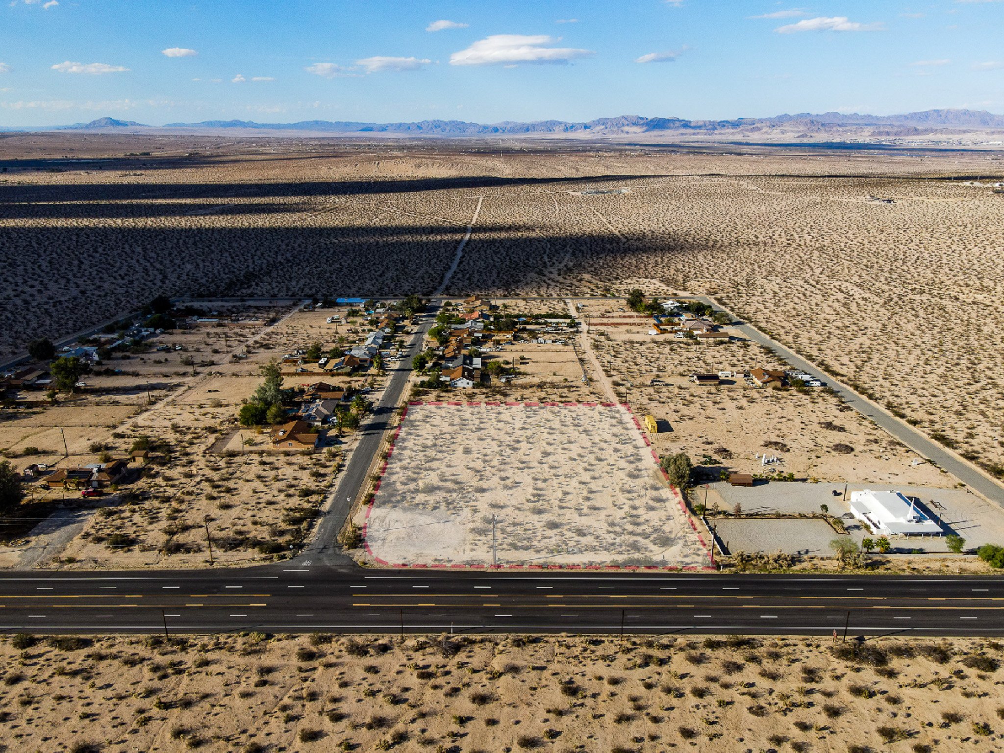
Aerial photography has become an invaluable tool for real estate listings, providing a multitude of benefits for both agents and prospective buyers. One of the primary advantages is the ability to capture stunning aerial views of a property, showcasing its full potential and highlighting unique features. This bird's-eye perspective provides a sense of scale and context, allowing potential buyers to visualize the property's surroundings and proximity to amenities. Moreover, aerial photography also helps to emphasize the property's selling points, such as a spacious backyard, a nearby park, or scenic views. By utilizing aerial photography, real estate agents can effectively showcase a property's true beauty, enhance its marketability, and attract a wider pool of buyers.
For $50 you get:
16 Directional Images (48MP, each of the cardinal directions from two different altitudes)
4–6 Panoramic Images (180*, 360*, and wide angle)
2–3 Images w/ Property Lines Added
1–2 Bird’s Eye Images (straight down)
Airspace Authorization (if necessary)
Basic Color Correction
Full Usage Rights to any media captured
*Some limitations apply (see below).
Additionally, all of our flights are fully insured with a minimum of $1M in liability insurance and conducted by an FAA Licensed sUAS Remote Pilot.
How It Works
Reserve your flight from our store with a credit card with secure checkout.
Once reserved, our team will contact you to schedule your flight date and discuss any specifics.
On your flight date, we’ll show up, check in if necessary, and fly the property to capture media.
Upon flight completion, we’ll color-correct your images and add property boundaries to a select few.
Your original and final images will be available via Google Drive and Adobe Lightroom (click to examples).
If We Can’t Fly…
No need to worry; we’ll notify you immediately and issue a full refund to your original form of payment.
ADDITIONAL SERVICES AVAILABLE
Aerial Videography & 3D Graphics Editing
Photogrammetry (Mapping & Surveying)
3D Scanning and Asset Inspection
Digital Surface Models (DSM) & Digital Terrain Models (DTM)
Topographic Contour Maps
Insurance Roof Inspections
Got Questions?
Sample Image Gallery


*The Fine Print
All standard sUAS operating limitations and FAA airspace restrictions apply.
Offer valid for residential real estate anywhere in the Las Vegas Valley/Las Vegas Metropolitan Area only.
Large-scale and High-rise Residential, Commercial, Government, and Industrial properties are excluded from this offer.
Offer available for a limited time. PAM reserves the right to cancel, suspend, or modify this offer at any time.