
Reality Capture at the Waste Isolation Pilot Plant
Large-area aerial mapping and three-dimensional documentation supporting the U.S. Department of Energy's Waste Isolation Pilot Plant in southeastern New Mexico.
The Assignment
PAM was engaged to complete a large-area aerial reality-capture project at the U.S. Department of Energy’s Waste Isolation Pilot Plant near Carlsbad, New Mexico.
The assignment covered more than 350 acres across an active industrial facility containing administrative areas, operational infrastructure, roads, construction zones, support buildings, ponds, and surrounding undeveloped terrain.
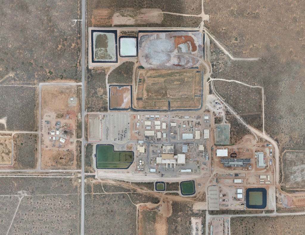
The objective was to produce a current, high-resolution visual record of the site through coordinated aerial image collection, photogrammetric processing, and delivery of both an orthomosaic and three-dimensional model.
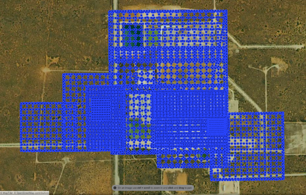
More than 7,000 aerial images were captured to support complete coverage across a site whose size, varied geometry, and operational complexity required a deliberate, segmented approach.
The Operating Environment
WIPP is a large, active U.S. Department of Energy facility with a mix of industrial infrastructure, secured operational areas, support buildings, roads, construction activity, ponds, and open desert terrain.
The site required careful coordination around access, active operations, personnel movement, infrastructure, and the practical limits of working across a broad facility footprint in southeastern New Mexico.
Environmental conditions also shaped the work. Heat, wind, glare, dust, and long travel distances between operating positions all influenced flight timing, aircraft deployment, battery management, and field efficiency.
The mission therefore had to balance complete visual coverage with safe, repeatable operations inside a complex government-industrial environment.
Planning the Capture
Capturing more than 350 acres in sufficient detail required the site to be divided into coordinated flight blocks rather than treated as a single continuous mission.
Each block was planned to maintain consistent image overlap, resolution, and coverage while accounting for the facility’s varied structures, roads, open terrain, construction areas, and operational boundaries.
Flight sequencing also had to support practical battery cycles, movement between operating positions, changing environmental conditions, and the large volume of imagery required for downstream photogrammetric processing.
The result was a structured capture plan designed to produce one connected site record from thousands of individual photographs, while leaving enough flexibility for field adjustments when site conditions required them.
Field Execution
Field execution followed the planned capture blocks while remaining responsive to conditions across the facility.
Each flight segment required consistent aircraft positioning, image overlap, camera settings, and altitude so the resulting imagery could be processed as part of one connected dataset. Battery changes, data-card management, aircraft checks, and movement between operating positions were coordinated to keep the collection progressing without sacrificing coverage or image quality.
Wind, glare, site activity, and the changing geometry of the facility required active judgment throughout the operation. Some areas could be captured through repeatable automated patterns, while more complex structures and boundaries required closer review and targeted supplemental collection.
Imagery and flight progress were checked throughout the project to identify incomplete areas, questionable coverage, or sections requiring another pass before leaving the site. By the end of the assignment, PAM had collected more than 7,000 aerial images across the full project area.
Processing and Deliverables
The field collection produced a large, interconnected dataset containing more than 7,000 aerial images. Those images had to be organized, reviewed, and processed as a coordinated site record rather than as a series of independent flights.
Photogrammetric processing combined the overlapping imagery into a high-resolution orthomosaic and a three-dimensional representation of the facility. The workflow required consistent image alignment, positioning, and quality review across industrial structures, roads, open terrain, construction areas, and other site features.
Processing outputs were checked for visible coverage gaps, alignment problems, distortion, and incomplete geometry. Areas with limited texture, reflective surfaces, shadows, or complex structures required particular attention because automated processing does not treat every surface equally.
The final deliverables gave the project team a detailed, current visual record of the broader WIPP facility that could support site documentation, planning, review, and future comparison.
What the Project Demonstrated
The WIPP project demonstrated that large-area reality capture is not simply a matter of extending a flight plan across a larger boundary.
Successful collection at this scale required coordinated planning, disciplined flight execution, consistent image quality, deliberate data management, and continuous verification that each flight block contributed to one complete site record.
It also reinforced the importance of connecting field operations to the final deliverable. The usefulness of the orthomosaic and three-dimensional model depended on decisions made before and during capture, including how the site was segmented, how coverage was maintained, and how incomplete or complex areas were identified before demobilization.
For PAM, the assignment became a clear example of how aerial data collection, operational judgment, and photogrammetric workflow must work together to document a complex industrial environment accurately and at scale.
Discuss an aerial data or documentation project.
PAM supports industrial, government, and infrastructure clients with large-area mapping, reality capture, and structured aerial documentation.