
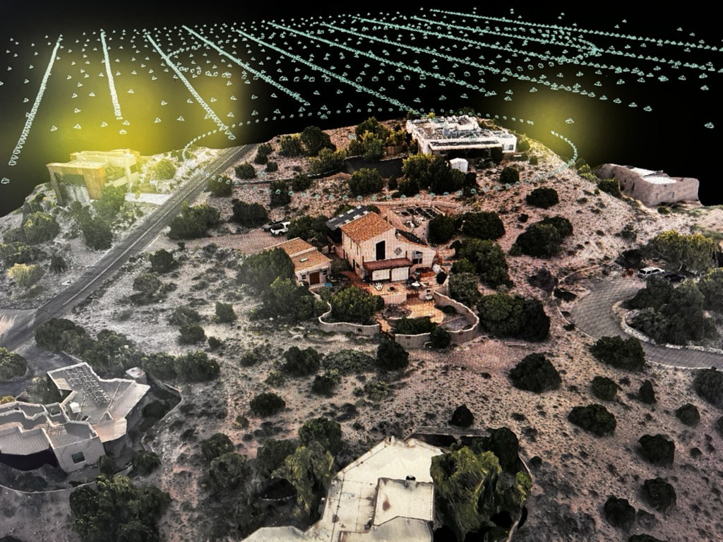

A digital twin is often presented as the polished end product: a detailed 3D model, an interactive map, or a navigable representation of a physical asset.
But the usefulness of that digital environment is determined much earlier.
It begins with the operational question, the capture plan, the control strategy, the sensor, the field conditions, and the discipline used to verify the resulting data.
A visually impressive model can still be incomplete, poorly scaled, difficult to repeat, or unsuitable for the decision it was meant to support.
Industrial reality capture is therefore not simply a matter of flying over an asset and processing the photographs afterward. It is a coordinated workflow that connects field collection to a defined business, engineering, inspection, or documentation need.
A digital twin is more than a 3D model
The term “digital twin” is used broadly, but not every 3D model functions as one.
A basic model may provide a useful visual record of a site. A more developed digital twin may connect that representation to measurements, asset records, inspection findings, maintenance history, sensor data, or repeated observations over time.
The distinction is not primarily visual.
It is operational.
A useful digital twin should help someone understand, compare, inspect, measure, plan, document, or make a decision about the physical environment it represents.
That means the first question should not be:
How do we capture the site?
It should be:
What does the organization need to learn, preserve, compare, or manage?
The answer determines the rest of the workflow.
Start with the operational question
Different objectives require different capture strategies.
A site overview for planning does not require the same level of detail as a model intended for close inspection. A construction-progress record differs from a condition assessment. A one-time documentation project differs from a program that will compare the same asset every quarter.
Before mobilization, the project should define:
- The physical area or assets to be captured
- The level of detail required
- The measurements or observations that matter
- The intended users of the data
- The required coordinate system
- The expected deliverables
- The software or platform that will receive the data
- Whether the site must be captured again in the future
- What level of positional confidence is actually necessary
This prevents a common failure: collecting a large volume of technically valid imagery that does not answer the client’s real question.
Capture planning shapes the result
High-quality reality capture depends on consistent coverage, appropriate geometry, and sufficient overlap between images.
The aircraft route must account for more than the site boundary. It must also consider the shape and height of the asset, vertical surfaces, obstructions, reflective materials, shadows, access restrictions, traffic, active operations, and the safe positioning of the flight crew.
A simple grid may be appropriate for a relatively flat site.
Complex industrial structures may require a combination of:
- Nadir imagery
- Oblique imagery
- Perimeter passes
- Vertical or façade capture
- Supplemental ground photography
- Targeted detail flights
- Manual capture around difficult geometry
The capture plan should be designed around the asset, not forced into a generic flight template.
Positioning, control, and verification
Accurate positioning is one of the foundations of reliable reality capture.
RTK or PPK-enabled aircraft can improve the positional consistency of aerial imagery and reduce the amount of ground control required for many projects. But precision positioning does not remove the need for verification.
Depending on the project, the workflow may still require:
- Ground control points
- Independent checkpoints
- Surveyed reference locations
- Known site features
- Coordinate-system confirmation
- Accuracy reporting
- Comparison against existing survey or engineering data
The important distinction is between claimed accuracy and verified accuracy.
A project should not be described as survey-grade, engineering-grade, or centimeter-accurate solely because an RTK-enabled aircraft was used. Those claims depend on the total capture, control, processing, and validation workflow.
For many industrial applications, repeatability may be just as important as absolute accuracy. If a site will be captured again, the same reference system, control approach, flight geometry, and processing standards should be preserved whenever possible.
Choosing the right sensor
No single sensor is ideal for every reality-capture project.
RGB imagery
High-resolution RGB photography is the most common foundation for photogrammetry. It can support orthomosaics, textured 3D models, point clouds, measurements, visual documentation, and progress comparisons.
Its effectiveness depends heavily on image quality, overlap, lighting, surface texture, and capture geometry.
Thermal imagery
Thermal data can reveal temperature differences that are not visible in standard photography. It may support inspections involving electrical systems, roofs, solar facilities, mechanical equipment, or other assets where thermal behavior is relevant.
Thermal imagery should not be treated as a decorative filter. Collection conditions, sensor calibration, environmental influences, emissivity, timing, and downstream interpretation all affect its value.
LiDAR
LiDAR can be useful where vegetation, low-texture surfaces, complex geometry, or limited visual contrast make photogrammetry more difficult.
It may also support workflows that require dense structural measurements or ground-surface information beneath partial vegetation cover.
The decision to use RGB, thermal, LiDAR, or a combination should follow the project objective. More sensors do not automatically create a better deliverable.
Industrial environments change the field plan
Industrial sites are rarely static capture environments.
The flight crew may need to work around:
- Active vehicles and equipment
- Restricted access areas
- Personnel movement
- Security requirements
- Radio-frequency interference
- Tall structures
- Cranes, wires, stacks, and towers
- Dust, heat, wind, and glare
- Limited launch and recovery areas
- Production schedules
- Site escorts or safety briefings
These conditions influence both safety and data quality.
A flight plan that looks efficient on a map may be impractical once site operations begin. Field teams need enough flexibility to adjust while preserving the integrity of the capture.
That is why pre-mobilization coordination matters. Site contacts, access notes, operating hours, safety requirements, known hazards, and asset priorities should be confirmed before the aircraft is unpacked.
Processing is not the same as quality control
Once imagery is collected, software can generate point clouds, meshes, orthomosaics, elevation products, and textured models.
The existence of those outputs does not mean the project is complete.
Quality control should assess:
- Coverage gaps
- Blurred or poorly exposed imagery
- Alignment errors
- Distorted geometry
- Surface noise
- Incomplete vertical features
- Positional consistency
- Checkpoint performance
- Coordinate-system accuracy
- Deliverable completeness
- Whether the output answers the original question
Some problems can be corrected during processing.
Others require a return to the field.
This is why field review is valuable before demobilization. Confirming that the required areas and details were captured can prevent an avoidable second site visit.
Deliverables should match the decision
Reality-capture projects can produce many outputs, but more files do not necessarily create more value.
Possible deliverables include:
- Orthomosaic imagery
- Georeferenced photographs
- Point clouds
- Textured 3D meshes
- Digital surface models
- Digital terrain models
- Elevation contours
- Inspection image sets
- Measurement-ready viewers
- Change-detection products
- Annotated site maps
- Asset inventories
- Web-based visualization environments
The correct package depends on how the information will be used.
A facilities team may need a simple browser-based environment. An engineering partner may need a point cloud in a specific coordinate system. A project manager may need repeatable orthomosaics for progress comparison. An inspection team may need organized imagery linked to asset locations.
Deliverables should be planned before capture, not discovered after processing.
What aerial capture cannot do by itself
Aerial reality capture has limits.
Drones cannot see through solid structures. They may not capture enclosed interiors, concealed components, deeply shadowed surfaces, or details blocked by equipment or vegetation. Some measurements or inspection conclusions require terrestrial scanning, handheld imagery, physical access, engineering review, or specialized nondestructive testing.
A digital twin should not imply certainty where the underlying data is incomplete.
The strongest projects define those limitations clearly and combine aerial capture with other methods when necessary.
Repeatability creates long-term value
A single high-quality model can be useful.
A repeatable capture program can become far more valuable.
When an asset is documented using consistent methods over time, organizations can compare:
- Construction progress
- Site changes
- Material movement
- Vegetation growth
- Surface deterioration
- Equipment placement
- Maintenance activity
- Asset condition
- Changes in access or surrounding terrain
Repeatability requires disciplined capture standards.
Flight paths, control, coordinate systems, sensor settings, naming conventions, processing methods, and quality checks should remain consistent enough to support meaningful comparison.
This is where reality capture begins to move beyond a visual deliverable and toward an operational record.
The field data is the foundation
A digital twin cannot become more reliable than the information used to create it.
Good software can process imagery efficiently, but it cannot recover surfaces that were never captured, correct every field mistake, or invent positional confidence that was not established during collection.
The most useful industrial reality-capture projects connect five things:
- A clearly defined operational question
- A capture plan designed around the asset
- Appropriate positioning and sensor selection
- Field execution that accounts for real site conditions
- Quality-controlled deliverables matched to the intended use
That is the difference between producing a model and building a usable digital representation of an industrial environment.
PAM supports aerial reality-capture projects from field planning and data collection through documentation, delivery, and repeatable program design.